OGC API - Tiles
A REST-ful JSON upgrade to WMTS
Tell Me More Get Started

Interoperable XYZ Maps

By adding some formality to what people have been doing for years with XYZ tilesets, the OGC API - Tiles Standard builds on the legacy of tiled maps . The Standard also specifies metadata elements that help clients do a better job at creating maps. This includes basic information such as a title or description, but also the available zoom levels, maximum x and y coordinates and even a custom map projection.

Why?

Main reasons for using OGC API - Tiles

Interoperable

Ensure that your application can read data from existing and new sources without changing how you communicate with them. Ensure that the data you share can be accessed by different clients, without having to share details of your implementation.

Check out an example here .

Based on Best Practices

The OGC Tiles - API Standard is based on the technologies and vocabularies that make up the web today, such as REST, OpenAPI, JSON and HTML. This helps ensure a smooth learning curve for any web developer, even if they are not familiar with GIS.

Developed by an independent Standards Body

The Tiles API Standard is a standard from the Open Geospatial Consortium (OGC) . The Standard was developed and is maintained through a member-driven consensus process, which creates royalty free, publicly available, open geospatial standards.

How does it work?

The OGC API - Tiles Standard describes how mapping clients (e.g.: web pages, desktop applications) can get information about tilesets and how to request the tiled data itself. Like the TileJSON specification, implementations of the OCG API - Tiles Standard provides a way to describe tilesets available on a server. At the same time, it supports more use cases, such as serving data which is not projected in Google Mercator. Unlike the OGC Web Map Tiling Service Standard (WMTS) , the Tiles API specifies the use of JSON instead of XML and is organized in a series of building blocks that can be easily integrated into other applications. These building blocks are mapped to conformance classes. One may choose to conform to one or more conformance classes, according to the complexity of the use case and the aimed degree of interoperability.
Learn more

See it In Action

This is a list of server implementations, that provide data. Please get in touch , if you would like to add your server to the list.

...

Blue Marble Next Generation (2004)

Powered by GNOSIS

The Blue Marble: Next Generation is a series of images that show the color of the Earth’s surface for each month of 2004 at very high resolution (500 meters/pixel) at a global scale. Map tiles.

...

Vineyards in Rhineland-Palatinate, Germany

Powered by Ldproxy

Have you ever wondered where the wine that you are drinking comes from? If the wine comes from the wine-growing regions Mosel, Nahe, Rheinhessen, Pfalz, Ahr, or Mittelrhein you can find this information in this API. Vector tiles.

...

Zaatari Refugee Camp مخيم الزعتري

Powered by MariaDB Geospatial

Zaatari is a refugee camp in Jordan, located 10 kilometres east of Mafraq, which has gradually evolved into a permanent settlement; it is the world’s largest camp for Syrian refugees. Coverage tiles.

...

Percent of People Who Travel by Bicycle to Work in East Lansing

Powered by Pygeoapi

Estimated percent of workers age 16 years or older who did not work at home, who commuted to work by bicycle in 2017-2021. Vector tiles rendered by an elasticsearch backend.

...

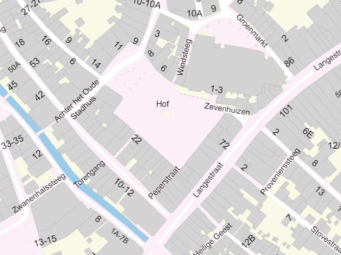
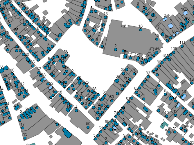
Key Register Large-scale Topography (BGT), Netherlands

Powered by GoKoala

Are you interested in large-scale topographic data of the Netherlands? In the Key Register Large-scale Topography (BGT) you can find all about building types, address labels, road segments (such as cycle paths, lanes, driveways, and shoulders), as well as topographic boundaries (such as fences and walls), terrain types, and water.

...

Key Register Addresses and Buildings (BAG), Netherlands

Powered by GoKoala

Looking for buildings or addresses in the Netherlands? In the Key Register Addresses and Buildings (BAG) you can find all buildings and objects (e.g. apartments) nationwide, including addresses, locations and attributes.

Get Started

Do you want to start using OGC API - Tiles? Before starting to implement the spec, please take a look at the existing implementations.

Servers by Technology
Java Ldproxy /
Python pygeoapi /
TiPg /
C/C++ GNOSIS Map Server
Scala franklin /
Clients by Technology
Python Pygdal Check GDAL's documentation .
JavaScript OpenLayers / , /
LuciadRIA
C/C++ GDAL /
GNOSIS SDK / Cartographer

Get Involved

Tell us what’s working well, what you want to see added or improved, and find out about new updates.

Discord

Chat with other users in the OGC API Tiles discord channel or in the matrix bridge .

GitHub

Found a bug, or want to give us constructive feedback?